Gros Morne National Park, Port au Choix to Saint Anthony
Over breakfast on the 7th of June 2011 we discussed the plans for the next week. Our quest was to find some icebergs..... We have been told that there are no icebergs in Twillingate as of yet, but there are some up in Saint Anthony. With our new found tool "The Ice Berg Finder" we set direction north on Hwy.430, the Viking Trail.
View Gros Morne, Port au Choix to Sanint Anthony in a larger map
It is a wonderful drive, however no speed records will be set on this trip. There are natural speed bumps in Newfoundland (not the only province) called pot holes, some I'm sure could eat a small car. This is especially true on the northern tip. Some of the other roads are pretty good though.
 |
| The Viking Trail - The road up to Saint Anthony and L'Anse aux Meadows |
 |
| Moose on the road - Drive carefully |
 |
| There is one |
 |
| One more |
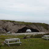
The Arches Provincial Park
Our first stop was The Arches Provincial Park. It is a small little park on the ocean with cave like arches in the rocks. This is supposedly ancient limestone carved by eons of pounding surf and tidal action have created these Arches. |
| Liz and Silvia by the Arches Provincial Park, NL. Canada |
 |
| Inside the arches, it loos just like it was taken out of Star Wars. |
You can walk under the Arches or on top of them just be careful, the ocean is unpredictable and gives no warnings. The Arches Provincial Park includes a parking lot, a boardwalk, and a picnic area.
 |
| Liz taking in the sights |
 |
| Silvia and Jörg coming down the boardwalk surrounded by ghost like trees. |
 |
| Rocks :) |
 |
| Sub Alpine Landscape |
We continue our drive through this incredible landscape. The further north we get, the landscape changes, and the sub alpine tundra is becoming more and more dominant.
Port au Choix - Port au Choix National Historic Site of Canada
Port au Choix and Port au Choix National Historic Site of Canada are really neat places to visit. For over 5500 years, this small peninsula on Newfoundland's west coast has been the crossroads of various native North American and European cultures. |
| The story about the Maritime Archaic Indians |
 |
| Back then |
The area's rich marine resources, and to a lesser extent the forests, wild game and abundant berries, have drawn these people to the shores and lands of Port au Choix.
 |
| Fascinating history |
The interpretative center is really good with a short movie and tons of history information. Very interesting.
The people who occupied this site connected the areas southwards to Maine, northwards to Greenland, as far west as the Canadian Arctic, and eastward all the way to Europe.
 |
| How they lived |
Many remains of these cultures have been preserved at Port au Choix. This is thanks to the limestone bedrock of the area. The soils are alkaline rather than acidic and thanks to this alkalinity many artifacts has been preserved, even some of those made of bone and ivory.
 |
| The town of Port au Choix |
 |
| Light house at the end of the road |
Over the past century various archaeologists have excavated several sites in the Port au Choix area. Through their work, there is now a better understanding of the many different people who called this site their home.
Some of these people were:
- Maritime Archaic Indians (5500-3200 B.P.),
- Groswater Paleoeskimo (2800-1900B.P.),
- Dorset Paleoeskimo (1900-1300 B.P.),
- Recent Indians; Cowhead, Beaches and Little Passage (2000-800 B.P.),
- Viking (1000 A.D.),
- Basque (1500-1700 A.D.),
- French (1600-1904),
- English (1700 - A.D.)
Saint Anthony
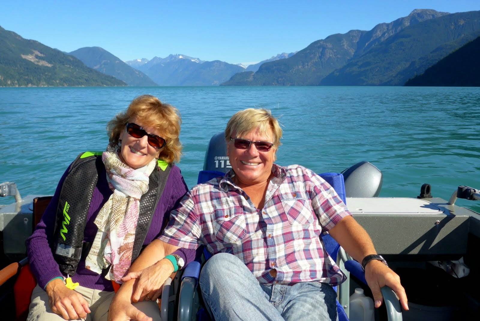
After a great lunch in Port au Choix we continued our travels north. The landscape changes about every 30 km, it is wonderful to see such beauty; a true balance and harmony in nature.
 |
| Jörg, Silvia and Anders talking tech talk while waiting for lunch |
 |
| Silvia and Liz exploring |
The drive over the northern tip of the island of Newfoundland is a bit rough to say the least. Most of the time we drove around 50-60 km/hr
 |
| Snow capped mountains |
 |
| Newfoundland at it's best.... just keep it coming. |
We arrived at our campground Triple Falls RV Park, just before Saint Anthony. Another great campground right on a river with wonderful owners. Make sure to pick up some "Bake Apple" (cloud berry) jam made by a local lady (I bought all they had). It is so good. As a kid growing up in northern Sweden, I remember my mom making this jam.... we called the berries "Hjortron". Mom then made home made waffles, then added the jam and whipping cream. Yum!
We booked in for two nights. Next on the agenda was Iceberg watching and L'Anse aux Meadows but we will cover that in our next blog.
For more pictures from this part of the trip, click the picture below.
Cheers,
Anders and Liz
11, 12, 13, 14, 15, 16, 17, 18, 19, 20
21, 22, 23, 24, 25, 26, 27, 28, 29, 29b
30, 31, 32, 33, 34, 35, 36, 37, 38, 39,
40, 41, 42, 43, 44, 45, 46, 47, 48, 49,
50, 51, 52, 53, 54, 55, 56, 57, 58, 59,
60, 61, 62, 63, 64, 65.
.
Here are some shortcuts to all the blogs from our Cross Canada Trip. Just hover over the number to see where it will take you
1, 2, 3, 4, 5, 6, 7, 8, 9, 1011, 12, 13, 14, 15, 16, 17, 18, 19, 20
21, 22, 23, 24, 25, 26, 27, 28, 29, 29b
30, 31, 32, 33, 34, 35, 36, 37, 38, 39,
40, 41, 42, 43, 44, 45, 46, 47, 48, 49,
50, 51, 52, 53, 54, 55, 56, 57, 58, 59,
60, 61, 62, 63, 64, 65.
.
Wonderful keeping up with this eastern adventure. I did notice that you're still in winter gear, well, so are we. Apparently the Victoria weather will improve after Canada Day, yes, we've heard that one before!! Happy Canada Day to you on that end of the country from the west coast
ReplyDeleteHugs, Suzanne
Your rock photo looks like a painting by Kristina Boardman, a Victoria artist. I am impressed by the amount of information available at all these wonderful spots. I'm sure you could spend days at each place and still not see everything.
ReplyDeleteLovin' the rocks!